September 29, 2014

Stinson Mountain

The weather this weekend was seasonably warm with temperatures forecast to be in the 80's and high pressure dominating the region. We couldn't pass up this chance to get in another "52 With A View" hike so on Friday I pulled up the list and took a look at our options. Keeping Toby in mind, we wanted a hike that was a reasonably close drive and to keep the round trip hiking route under 4 miles. We settled on Stinson Mountain, a moderate peak on the southern edge of the White Mountains with a 1.8 mile trail to the summit. With the decision made, on Friday evening we quickly organized our gear, snacks, and all of the other things you need to leave the house with a toddler.

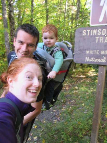
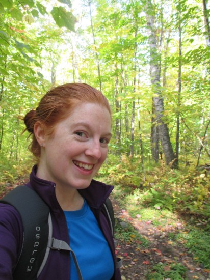
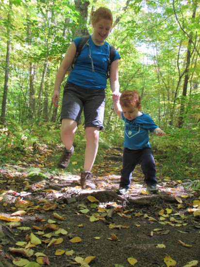
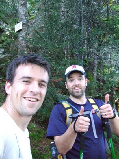
We were up early on Saturday morning and with most of our stuff ready to go, it was just a matter of the three of us eating breakfast, getting dressed, and heading out. "We're oddly on schedule." Katy said at one point as we made it out the door and on the road by 7:30AM. It was a nice ride up as we noticed that many of the trees were already turning for foliage season up in NH. We made one quick pitstop on the way to use the restroom and feed Toby a quick snack and then continued on to the trailhead in Rumney, NH. It was uncharted territory for us, as this trail is 15 miles off the main interstate and not near any other trails that we've hiked before in our NH 4000 footer quest. Early fall, a warm clear New England day, and exploring the backroads and hiking trails of Rumney, NH - sounds like an episode of Chronicle!

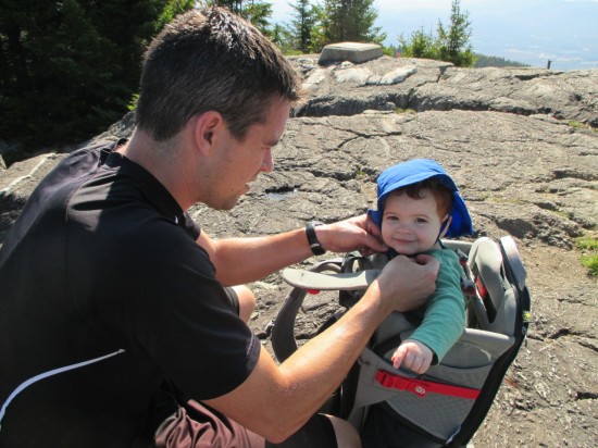
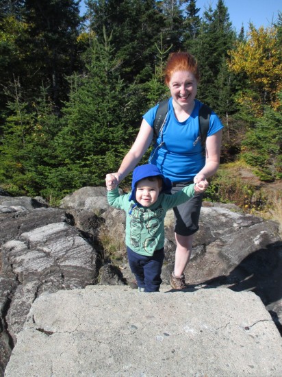
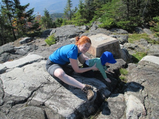
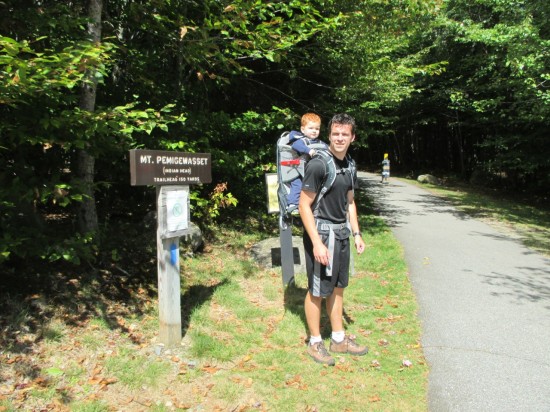
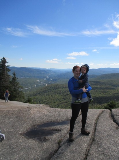
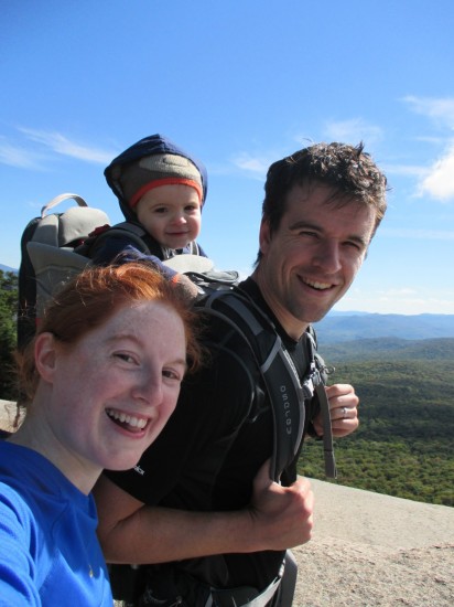
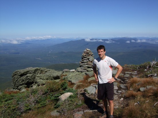
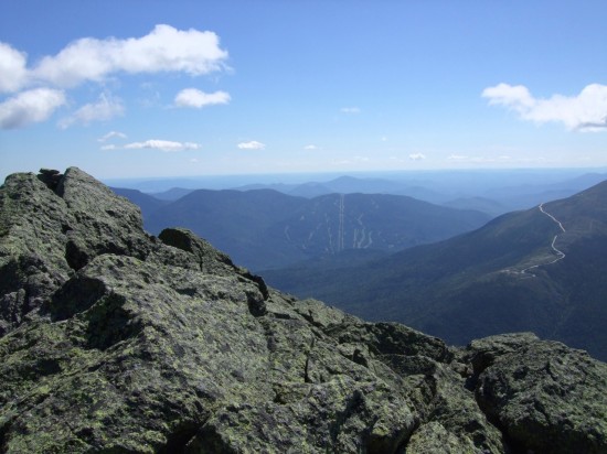
We arrived at the small parking lot at the trailhead which was already filled to capacity with 4 cars. We parked on the side of the road and got ourselves organized before heading off, on the trail at exactly 10:00AM. As usual, Toby was very enthusiastic on this early portion of the hike and was talking the whole way up. Stinson Mountain Trail is well maintained and easy to navigate but it was definitely a climb. With 1400 feet of elevation gain over 1.8 miles, it's a little more then just a walk in the woods. We made it to the top without much issue, though, in about an hour's time, and were treated to some excellent views of the valley. We took Toby out of his pack and all had a PB & J snack while Toby tirelessly climbed on every single cement remnant of the old firetower that clearly used to be at the top of this peak but is now gone.

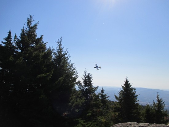
We were doing our usual photo-ops when Katy noticed a small plane flying in the distance and she suggested that Toby and I pose for a picture with the plane in the background before we head down. Sure why not? We got Toby in his pack and in position on a rock ledge, Katy lined up the shot, and then she tried to get a good angle. "Oh the plane is getting closer," she says. "It's coming this way." I continued to wait... "It's coming right towards us." I was still waiting at this point wondering how long I needed to stand there. "Umm, Owen I think you should get down from there." As she was saying all of these things I was continuing to wait for her to take our picture with my back to the plane until I finally turned around when she said this. To my surprise, the plane was only a few hundred yards away coming directly at us. At that moment there was no other explanation in my mind why the plane would be in that position and on that course unless it was coming in for a crash landing. We both started running off of the rock ledge and I was about 3 to 4 seconds away from diving for cover into the dirt behind the nearest rock or tree, baby on my back and all.

But then, the plane pulled up at the last second and flew straight up and over us! Katy's first reaction was to laugh while simultaneously flipping the pilot off with both hands as he looped back around and made multiple fly by's while waving at us. I was just in disbelief with adrenaline pumping and glad we were all still in one piece. It was definitely a very bizarre experience and something we will laugh about for a while. Before long, the plane had flown off and we were making our way down the trail we came up. By comparison's sake, it was an uneventful hike down and journey home, but an overall great outing for our 2nd peak on the NH 52 With A View!

stinson1
stinson2
stinson3
stinson4
stinson5
stinson6
stinson7
stinson8
stinson9
stinson10
stinson11
stinson12
stinson13
stinson14
stinson15
stinson16
stinson17
stinson18
stinson19

September 18, 2014

Mount Pemigewasset

As I mentioned in our previous outing to Lonesome Lake, Katy and I decided to start tackling the NH 52 With A View list and bring Toby along for the ride. This past weekend, we embarked on our first of hopefully many hiking trips on this list by climbing Mount Pemigewasset.

Mount Pemigewasset is a small peak at the southern end of Franconia Notch that looks like a little nub that you can see when driving by on Interstate 93. It's an appealing hike for a small outing because of its relative driving proximity, the moderate 3 mile round trip climb, and the open ledges at the top. I've mentioned it as an option several times in the past when we've been considering a small hiking trip, but we've always opted for another alternative instead. Katy tells me that it was because she always associates the word Pemigewasset with bears because of an article we once saw about a bear encounter in the Pemigewasset Wilderness.

We got up on Sunday morning with our usual routine, still not 100% committed to making the trip. After having breakfast and getting Toby up and ready, we decided to go for it and began to get organized. It was another perfect fall day that was just not to be passed up. We were all ready to go around mid morning and headed out the door. It took a few false starts to get going though, as I think Katy and I each had to go back into the house once or twice to get something (diaper bag? sweatshirt? I don't even remember). We finally were situated though and were off. We made a stop on the way up to feed ourselves and Toby lunch, before continuing on and arriving at the large parking area for the Flume Gorge Visitor Center around 1:00PM.

There was plenty of activity at the visitor center as we got organized for the hike. Toby was excited to go in the carrier once again and we started heading up the trail. NH 52 With A View hike #1 had begun! But wait, 100 yards in and another false start. I had forgotten to put my long sleeve shirt in the pack so we had to go back to the car to get it. We recovered and were quickly back on the trail. The trail to the summit is fairly straightforward, with moderate elevation gain and is well maintained. We passed by a number of groups on the way up, and I think just about all of them had something to say to Toby or about Toby. He has a way of making friends quickly that kid! We even stopped once on the way up to take him out of the pack, and let him hike on his own with some help. We arrived at the summit ledges in just over an hour and stopped for a bit to take in the views over the notch as advertised.

We headed back down the way we came with little trouble and then spent a few minutes at the visitor center before heading home. The hike was a success and a great time was had by all of us. Looking forward to the next one!

pemi1
pemi2
pemi3
pemi4
pemi5
pemi6
pemi7
pemi8
pemi9
pemi10
pemi11
pemi12
pemi13

September 16, 2014

Jefferson and Adams

For a long time now, my brother Brian and I would periodically have this conversation: (O or B): "We should do a hike sometime." (B or O): "Yes we should." End of conversation. With both of us having young children now, weekends are busy and it's easy to either have a conflict or just not get around to planning these things out. Well, we finally decided it was time. After bouncing around a few ideas, we settled on a loop over Mount Jefferson and Mount Adams via the Castle Trail on the way up and Lowes Path on the way down. It seemed like a good choice with a long stretch of above treeline hiking and neither of us had been on the Castle Trail before. The plan was set for two Sundays ago with perfect weather in the works.

With a hefty day ahead of us, we made plans to meet at the Park and Ride lot in Nashua at 5:30AM. We both pulled into the lot at nearly the exact same time, and Brian jumped in my car to continue the ride up together. We stopped at a Dunkin Donuts on the way (I skipped the pre-hike donut but Brian couldn't resist) and were at the trailhead and on the trail at about 8:00AM. It was cool but comfortable and clear, with the higher summits forecast predicting excellent above treeline conditions in the 40's with moderate winds. The first mile or so of the trail was an easy warmup, with the trail in good shape and minimal elevation gain. Then we began to climb.

The middle third of the ascent was a steady upward trek and we eventually popped out above treeline under clear skies. It was here that we hit the "castles" portion of the trail which is a good section of large rocky towers that required some fun scrambling to get over. We continued up along the ridge line and eventually made it to the summit at 11:00AM. It wasn't until we were nearly at the top of Jefferson that we ran into the first group of other hikers that we'd seen. From a distance, it looked like a man hiking with a young kid. As we got closer, we noticed he was carrying a second child in a front carrier. Impressive! As we got even closer, though, we realized that not only was he carrying a child on his front, he was also carrying another child on his back! Nice!

We ate a snack on top of Jefferson and then continued on to the summit of Adams. The hike along the ridge was much higher traffic with many other hikers hitting the high peaks on this day. We made our way up the bouldery summit cone of Adams and took another break at the top. Of all the Presidentials, Adams is definitely the meanest in terms of jagged boulder hopping and tricky footing. The winds were whipping at the peak and we spent some more time up there before heading back down. The descent down Lowes Path was excellent with a very long stretch still above treeline overlooking the valley. The lower portion of the trail seemed to go on forever, though, with a bit of a death march grind back to the road and an extra mile of flat walking to complete the loop. We completed the hike just before 4:00PM coming in under 8 hours.

Overall, it was a great day and I'm glad we finally got out there. I'm looking forward to hopefully getting some more hikes in again soon.

jeffersonadams8
jeffersonadams7
jeffersonadams6
jeffersonadams4
jeffersonadams3
jeffersonadams2
jeffersonadams1