September 29, 2015

Madison and Adams

About a month ago, Brian suggested that we go on a hike. Sounds like a great idea! After some coordination, we finally found a date that works, and we were locked in with a plan for this past Saturday. Since finding time to get these hikes in is not always easy to come by these days (Katy and I have two young children now and Brian has a toddler of his own keeping us all busy), I put some careful thought into what hike we should do. The criteria in my mind was something like this:
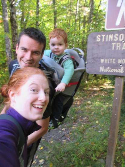
  1. Do-able in a single day, including driving there and back
  2. Big enough to be worth our while, somewhere in the 10 - 15 mile range
  3. Preferably prolonged, above treeline exposure for maximum views and remoteness "feel"
  4. Include a unique trail or two, one that is less heavily traveled and that we haven't done before
That's a pretty picky checklist, but hey why not be picky? And looking at the list, there was really one one place to go - back to the Northern Presidentials. Last year we took on a hike that met all of those checkboxes in the form of a Jefferson and Adams loop. This year, I figured we could go at it from the opposite side with a Madison and Adams loop. The key to this choice and one that checks off that last box on the list was to make the ascent from the Randolph East parking area up the Howker Ridge Trail. While we've both been up these mountains before, neither of us have been up this trail which avoids the typical and more heavily traveled routes leaving from Appalachia.

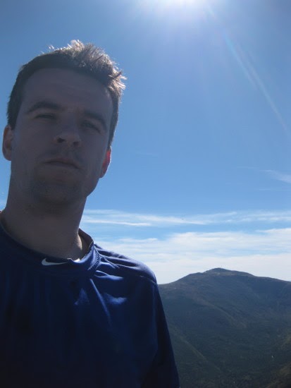
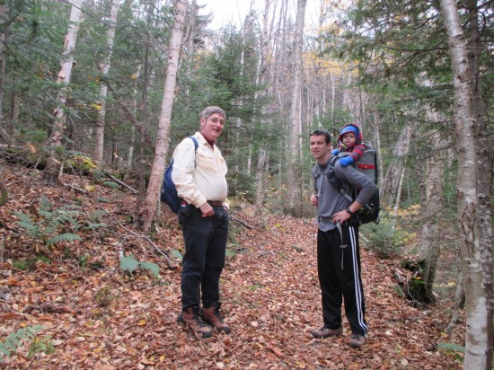
So the plan was set. We would meet at the Park and Ride lot in Nashua at 5:30AM to begin the day. Somewhere along the way, though, before the planned date, our twosome turned into a foursome. Mo and David, who are working on their 4000 footers list, joined the group for the outing. We added a daisy-chain to the carpool plan with Brian and I meeting at the Nashua Park and Ride at 5:30AM and then continuing on together to meet Mo and David at the Hooksett Park and Ride at 6:00AM. Fully consolidated, we made it to the Randolph East parking area at around 8:00AM. The weather was cool and clear and the forecast was for an absolutely perfect day in the high peaks. After getting organized for a few minutes, we were off.

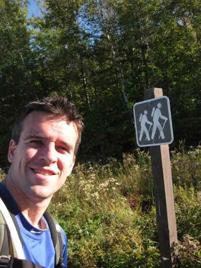
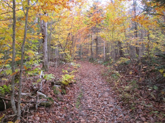
The initial part of the hike was gradual and steady. We moved along at a reasonable pace and began to climb. There's a bit of a backstory to this hike, though, as not all members of the party ended in as good a shape as they started. Brian was actually on the fence about coming all week leading up to it, as his son brought home a nasty stomach virus early in the week that he caught and was still recovering from. He made the decision to go for it the night before, though, and early in the hike he was beginning to feel the effects of basically not eating all week. About halfway up Madison, he asked for the map and was planning an escape route. He was still going up Madison but didn't think he was up for the Adams portion of the hike. Nevertheless, we continued on.

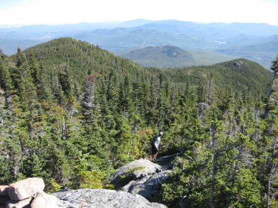
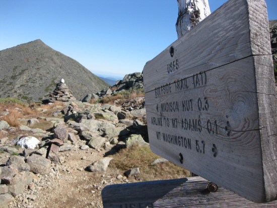
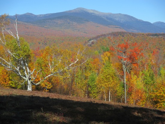
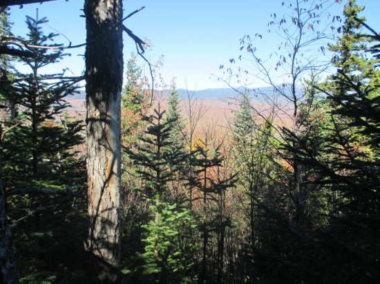
A couple hours into the hike, we finally popped out above treeline. The Howker Ridge Trail did not disappoint as we made our way up and over each of the exposed "Howks" under the warm sun, clear skies, and calm conditions. We made it to the summit of Madison in about 3 hours or so and stopped for lunch and to soak in the views. After spending some time on the summit, we made the relatively simple descent from the Madison peak down to the Madison Hut. Brian made it, but he decided that he was done climbing up for the day and would skip Adams. Our original plan had us climbing up and over Adams without doubling back, but we modified our route slightly so that we could meet up with Brian and descend Airline after tagging the Adams summit.

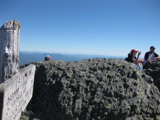
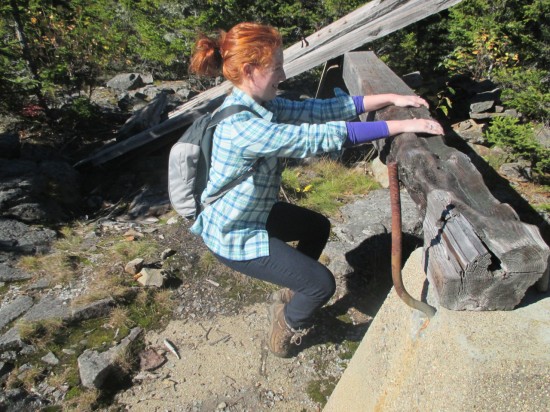
So after a quick break, Mo, David, and I continued on to the summit of Adams. We actually made an error here as we planned on taking one trail to the peak but ended up on another. It turns out there are two trails from the hut that both will bring you to Adams in about the same distance. The difference is that the trail we took had some really neat, scrambly sections that required some more technical maneuvers to get up. Overall, it was a good mistake, and we made it to the summit in about an hour. We spent some time up there, but with a weird cloud of flies and mosquitos right on the peak, we headed down before too long. We made it back to the meeting point with Brian in reasonable time to continue our descent.

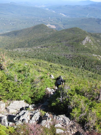
We headed down Airline which is a nice trail that keeps you up on the ridge line for a little ways before finally ducking down out of the Alpine Zone. While on the ridge we were eyeing the multiple routes up Kings Ravine to our left that looked absolutely unbelievable. Someday we'll have to return for a thrill and ascend up that headwall. In any case, we continued down, with Brian and I leading the front pack while Mo and David were separated a bit behind.

The hike down was a bit of a grind, with an interesting twist happening towards the end. Brian, of course, was still not feeling well but was gutting it out on the descent. However, while the two of us were waiting at a trail junction for Mo and David to meetup, Mo came running down and handed us her keys. She said to go ahead and get the car and bring it over to Appalachia to pick up David. I at first thought that David had some type of serious injury and we were going to need to mount a rescue operation. A few seconds after that though, though, David came strolling up behind Mo. It turns out that he, too, was starting to feel queasy and wanted to get done as quickly as possible.

So with both Brian and David feeling ill, I completed the last mile and half of the hike on my own to retrieve the car, while Mo, David, and Brian went one mile to Appalachia. After an easy walk, I picked up the car, retrieved the three of them down the road, and the hike was complete. We headed back, stopping for some pizza on the way home, to complete another epic day.

Despite the unusual twists, I really enjoyed the day and the hike. Hopefully we'll be back out there again soon.

IMG_5459
IMG_5457
IMG_5461
IMG_5462
IMG_5464
IMG_5470
IMG_5471
IMG_5474
IMG_5475
IMG_5477
IMG_5478
IMG_5481
IMG_5483

October 30, 2014

Iron Mountain

In my previous Mount Avalon post, I described how we managed to get in a 52 With A View peak during our recent trip to AL and UP's condo in the White Mountains. However, what I didn't mention in that post is that during that same trip, and on the very next day after hiking Mount Avalon, we bagged another peak! We woke up on Monday morning without too many plans, with the exception of eventually packing up and heading home after an enjoyable holiday weekend. With the sun already shining and warmer temperatures then the day before, we thought it would be fun to get in another quick hike in the morning. The trailhead for Iron Mountain was only a few minutes drive away, and the hike itself was less than a mile each way. We asked around to see if anyone from the previous day's hiking team was interested in coming along, but didn't have any takers. So we quickly got dressed and headed out the door with the smaller crew of Owen and Katy plus Toby.

The road to the trailhead was a long, narrow dirt road. It was in good shape and we made it to the trailhead with no trouble but it definitely seems like it could be tough to get two cars past eachother in some spots. When we finally reached the trailhead, there was a small little parking area with room for about 5 or 6 cars with 3 other cars already there. We squeezed in a spot and got ready for the hike. Right off the bat the trail takes you through an open field with really nice panoramic views of the Presidentials. These were probably the best views of the entire hike. We worked our way up the easy trail and navigated the .8 miles in no trouble. About halfway to the top, Toby fell sound asleep and I could hear him snoring in my ear as we worked our way up the trail.

The summit is wooded with minimal views, and we opted to skip the extended trip to the ledges on the other side which would add another mile each way to the hike. Overall, though, it was a very enjoyable morning outing, and we were finished and back to the condo in time for lunch.

iron1
iron2
iron3
iron4
iron5
iron7
iron8
iron9
iron10
iron11
iron12
iron13
iron14
iron15
iron16
iron17

October 15, 2014

Mount Avalon

Katy, Toby, and I spent this past weekend at my Aunt and Uncle's (AL and UP) condo in Bartlett, NH taking a long break from Friday to Monday. Columbus Day weekend is typically considered the peak of fall foliage season in northern NH and this year it did not disappoint. We drove up early on Friday morning surrounded by nice weather and beautiful fall colors before spending a low-key day with AL and UP. Toby got accustomed to his new surroundings which he may or may not remember from a year ago when we visited on the same weekend when he was just 4 months old. My sister Mo and her boyfriend David also arrived later on Friday evening to spend the weekend as well.

Naturally, whenever we spend time at the condo we always like to take advantage of the opportunity to get some hiking in. Since Mo and David were looking to bag some 4000 footers, and we were working on the 52 With A View list, we thought it would make sense to find a hike where those two lists intersect. We found our answer with a hike departing from Crawford Depot in Crawford Notch. The first 2 miles of the hike bring you to the top of Mount Avalon which was our destination and a 52 With A View peak. From there, Mo and David could continue on to Mounts Tom, Field, and Willey to bag those three 4000 footers and we could turn around and head back down. The plan was set for Sunday morning where we would reunite the hiking team of Owen and Katy + Mo. (And David. And Toby. And UP.)

We got up at a reasonable hour on Sunday morning, planning to be out the door of the condo at 8:30 AM. We ended up probably a few minutes behind schedule and leaving just before 9AM. Katy, Toby, UP, and I headed out in our car, while Mo and David took theirs. To make their hike more interesting, we also arranged to meet at the Willey House site and spot a car for Mo and David to turn their hike into a traverse. By the time we did the whole car drop, drive to Crawford Depot, organize our gear, and use the restrooms, it was about 9:30 AM and we were on the trail. It was quite chilly at the start, with temperatures in the 40's and the warm layers, hats, and gloves on. I made fun of Katy for having to borrow UP's hat and gloves again after we both had to do the same thing 4 years ago when we originally bagged Tom, Field, and Willey on this same weekend. Despite the mishap, we were all warm and ready to go.

The hike up Avalon is not difficult but does have a fairly steep section for the last half mile. We worked our hiking team up the mountain as Toby once again narrated what he saw. Our hike started off with some cloudiness, but as we approached the top, the clouds began to burn off. The view from Avalon is quite nice with angles looking down into Crawford Notch as well as overlooking the Crawford Depot where we started. After giving Toby some time out of the pack, snapping a number of photos, and grabbing some water and a snack, we headed back down. It was here that we wished Mo and David good luck as they had a grander destination. Katy, Toby, UP, and I headed back down to the car.

After separating from Mo and David, Toby began to protest his current situation. I can't say for certain what he was complaining about, but it was his first prolonged stretch of unhappiness that we have experienced while hiking with him. We stopped and gave him some water and a snack, and did a quick smell test for the diaper, but once we started to continue on again, he continued to cry. I think he might have gotten cold hands when his gloves fell off for a few minutes. In any case, nothing was helping, and we were a mile and half away from the car. I didn't have much choice but to just hike with a crying baby on my back. I have to say that this is probably the first time that I really felt judged for doing what we do. I know many people have varying, and perhaps very strong opinions about hiking with a baby, but I didn't really feel those opinions until that moment. I had to pass many people on the way down the mountain while Toby was very unhappy, and the looks and comments I got came in all shapes in sizes, some positive, some not so.

Not long after Toby started doing this, I at one point took a look back at Katy and she just waved her hands forward "Don't wait for me." she said. So I headed down, as swiftly and safely as I could. I started talking to Toby, asking him where the sky was, where the trees were, and where the rocks were. This in combination with the jostling of the quick pace began to calm him down. His cries got slower and he clearly was getting tired. He finally fell asleep on my back and the last 10 minutes of the hike I heard Toby snoring in my ear. I got to the bottom around 12 PM and took a seat at a picnic table. Toby woke up and was as happy as ever, and we sat there looking at the passers by and the cars until Katy arrived about a half hour later. We got Toby situated in the car at that point and then UP arrived shortly after that so we could head back to the condo and have some lunch.

I hope someday Toby looks back at the adventures that we brought him on and appreciates the way we helped him learn about the world when he was young. More likely he will probably just say, "Mom and Dad, you were crazy." I'm ok with that too.

avalon1
avalon2
avalon3
avalon4
avalon5
avalon6
avalon7
avalon8
avalon9
avalon10
avalon11
avalon12
avalon13

September 29, 2014

Stinson Mountain

The weather this weekend was seasonably warm with temperatures forecast to be in the 80's and high pressure dominating the region. We couldn't pass up this chance to get in another "52 With A View" hike so on Friday I pulled up the list and took a look at our options. Keeping Toby in mind, we wanted a hike that was a reasonably close drive and to keep the round trip hiking route under 4 miles. We settled on Stinson Mountain, a moderate peak on the southern edge of the White Mountains with a 1.8 mile trail to the summit. With the decision made, on Friday evening we quickly organized our gear, snacks, and all of the other things you need to leave the house with a toddler.

We were up early on Saturday morning and with most of our stuff ready to go, it was just a matter of the three of us eating breakfast, getting dressed, and heading out. "We're oddly on schedule." Katy said at one point as we made it out the door and on the road by 7:30AM. It was a nice ride up as we noticed that many of the trees were already turning for foliage season up in NH. We made one quick pitstop on the way to use the restroom and feed Toby a quick snack and then continued on to the trailhead in Rumney, NH. It was uncharted territory for us, as this trail is 15 miles off the main interstate and not near any other trails that we've hiked before in our NH 4000 footer quest. Early fall, a warm clear New England day, and exploring the backroads and hiking trails of Rumney, NH - sounds like an episode of Chronicle!

We arrived at the small parking lot at the trailhead which was already filled to capacity with 4 cars. We parked on the side of the road and got ourselves organized before heading off, on the trail at exactly 10:00AM. As usual, Toby was very enthusiastic on this early portion of the hike and was talking the whole way up. Stinson Mountain Trail is well maintained and easy to navigate but it was definitely a climb. With 1400 feet of elevation gain over 1.8 miles, it's a little more then just a walk in the woods. We made it to the top without much issue, though, in about an hour's time, and were treated to some excellent views of the valley. We took Toby out of his pack and all had a PB & J snack while Toby tirelessly climbed on every single cement remnant of the old firetower that clearly used to be at the top of this peak but is now gone.

We were doing our usual photo-ops when Katy noticed a small plane flying in the distance and she suggested that Toby and I pose for a picture with the plane in the background before we head down. Sure why not? We got Toby in his pack and in position on a rock ledge, Katy lined up the shot, and then she tried to get a good angle. "Oh the plane is getting closer," she says. "It's coming this way." I continued to wait... "It's coming right towards us." I was still waiting at this point wondering how long I needed to stand there. "Umm, Owen I think you should get down from there." As she was saying all of these things I was continuing to wait for her to take our picture with my back to the plane until I finally turned around when she said this. To my surprise, the plane was only a few hundred yards away coming directly at us. At that moment there was no other explanation in my mind why the plane would be in that position and on that course unless it was coming in for a crash landing. We both started running off of the rock ledge and I was about 3 to 4 seconds away from diving for cover into the dirt behind the nearest rock or tree, baby on my back and all.

But then, the plane pulled up at the last second and flew straight up and over us! Katy's first reaction was to laugh while simultaneously flipping the pilot off with both hands as he looped back around and made multiple fly by's while waving at us. I was just in disbelief with adrenaline pumping and glad we were all still in one piece. It was definitely a very bizarre experience and something we will laugh about for a while. Before long, the plane had flown off and we were making our way down the trail we came up. By comparison's sake, it was an uneventful hike down and journey home, but an overall great outing for our 2nd peak on the NH 52 With A View!

stinson1
stinson2
stinson3
stinson4
stinson5
stinson6
stinson7
stinson8
stinson9
stinson10
stinson11
stinson12
stinson13
stinson14
stinson15
stinson16
stinson17
stinson18
stinson19